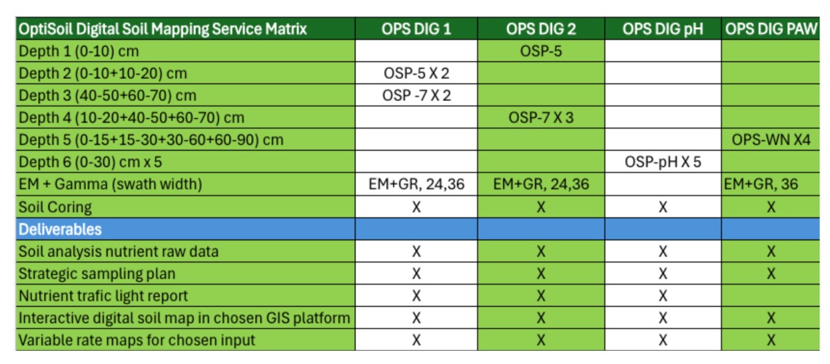
Digital Soil Mapping
Zoning Analysis:
- Soil maps delivered interactively in chosen GIS platform, in addition to PDF. Field zoning by integration of available yield and soil maps.
- Chemical and physical properties.
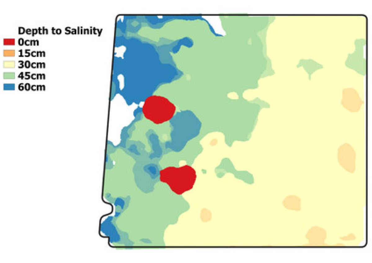
- Depth to constraint maps, 3D understanding of constraints to root growth.
- Quantification of spatial uncertainty to ensure soil maps are fit for purpose.
- Statistically based spatial modelling to identify soilbased yield drivers.
- Analysis of importance of individual measured and mapped soil properties on yield variation in each season. Yield drivers change depending on the most seasonally apparent constraint.
- Zone maps, variable rate files and trial design supplied to
PCT Agcloud or other platform of choice.
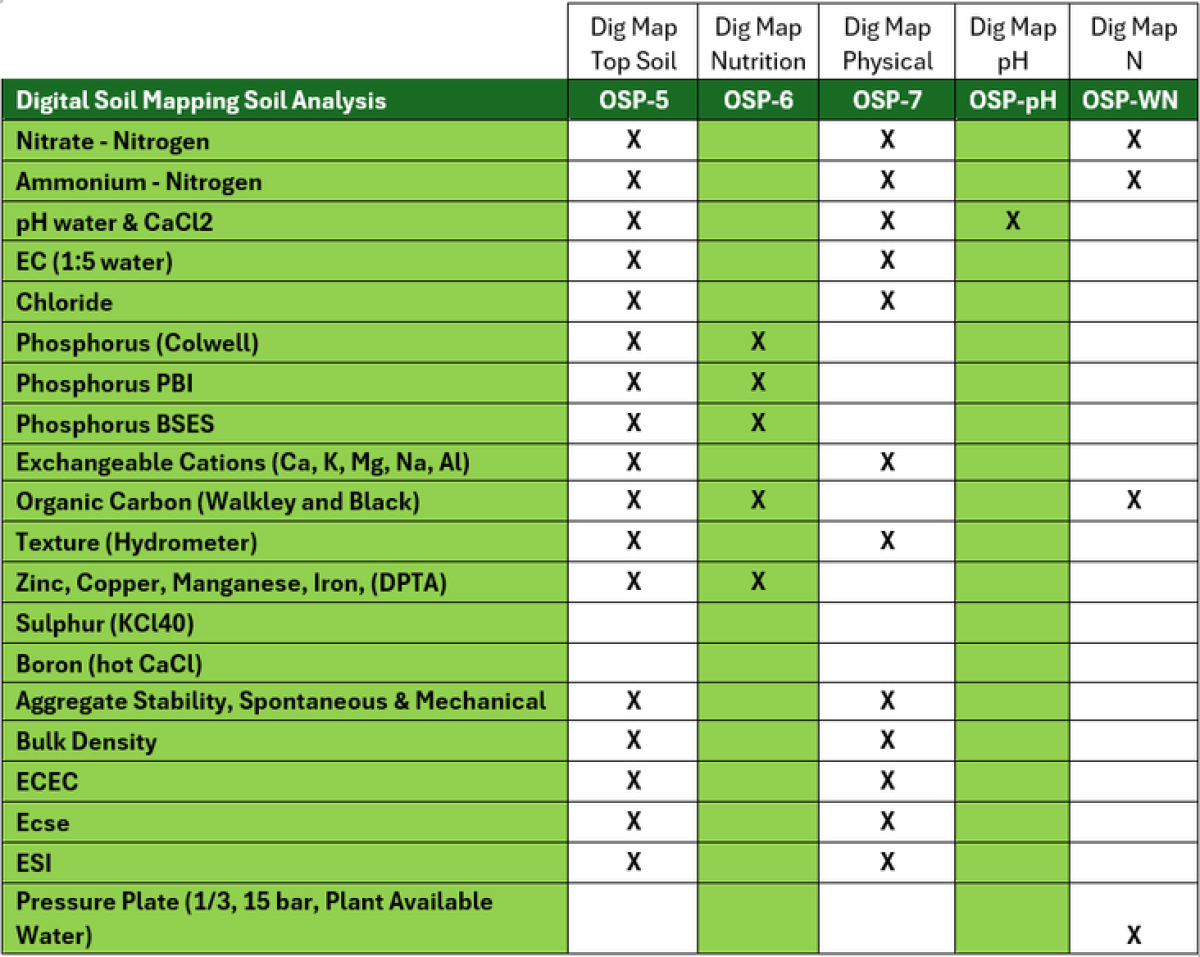
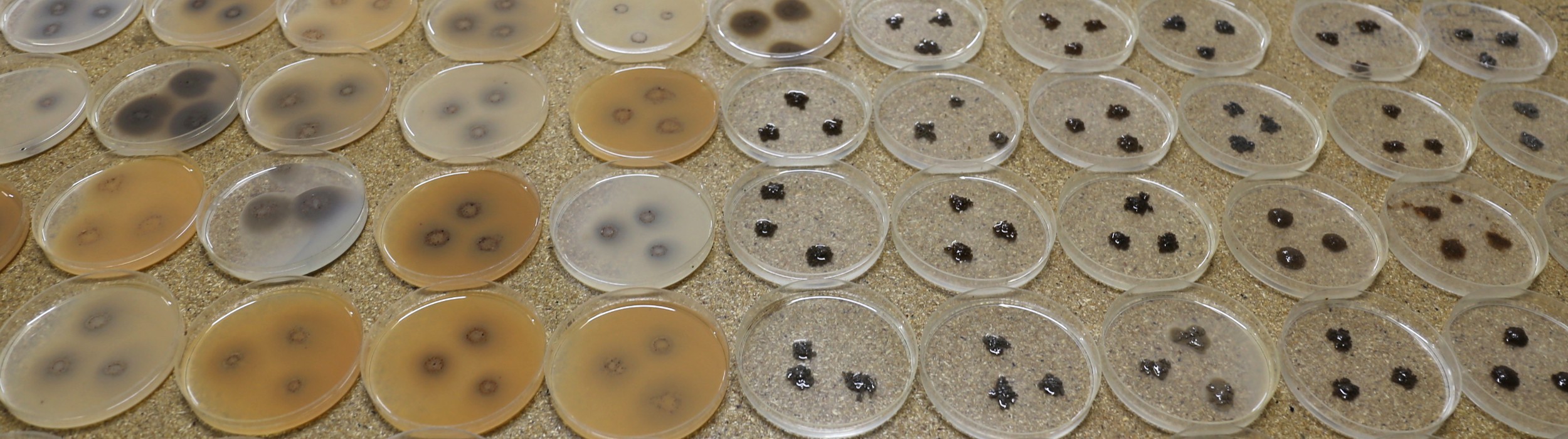
Soil analysis:
- Chemical & physical analysis on 4 soil segments between 0 and 100cm to facilitate 3D soil maps.
- Additional analytes and combinations are available for specific needs.
- Test methods are based on procedures as described in Soil Chemical Methods – Australasia (2011) Rayment and Lyons.
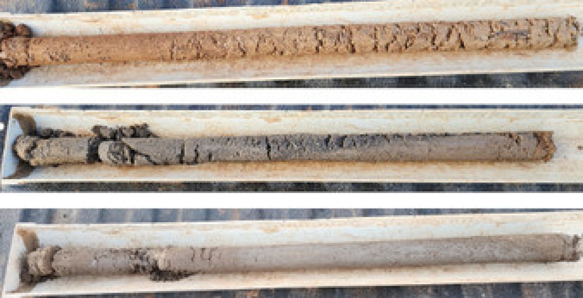
Soil coring:
- Intact 0-100 cm, 50mm cores.
- Allowing for calculation of bulk density and visual analysis of soil through the profile for the identification of textual and colour changes, compaction layers and rooting depth.
*OptiSoil has a flexible approach to sample design and characteristics to be measured. Including grid sampling. All jobs will have a detailed quote attached.